An unexpected dump of snow has caught western Newfoundland a little off guard this morning.
The Corner Brook vicinity awoke to a heavy blanket of fresh powder and a snowfall warning issued by Environment Canada with 15 to 20 centimetres of snow expected by early afternoon.
Heavy snow and areas of blowing snow will continue into this afternoon as a narrow band of snow streams in from the Gulf of St. Lawrence.
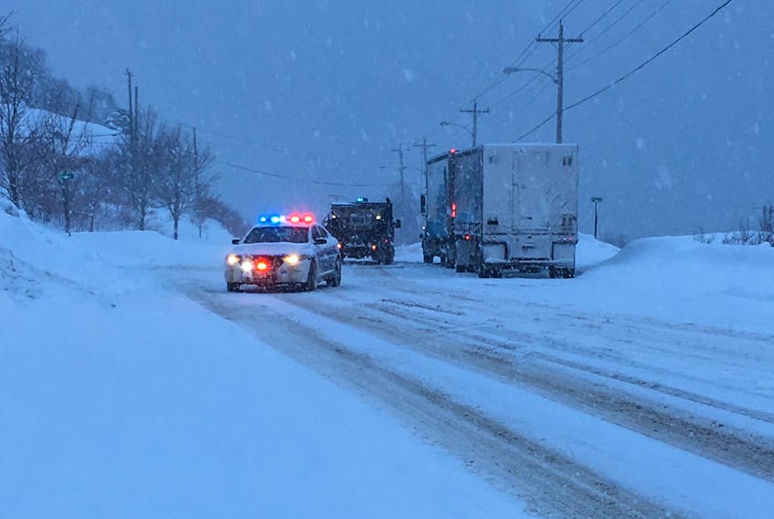
Travel is also treacherous. RCMP Traffic Services West issued an advisory regarding snow squalls between Deer Lake and Stephenville. The police advised motorists to slow down and use extreme caution, as visibility was poor due to quickly accumulating snowdrifts.
Environment Canada has also issued a special weather statement for the entire western region and beyond region as a powerful winter storm is expected to move through the Gulf of St. Lawrence on Friday.
A warm front associated with the storm will cross Newfoundland Thursday night and bring snow and blowing snow to most of the island before changing to rain by Friday morning.
The winds are expected to be the biggest concern with this system, according to the weather alert.
Strong easterly or southeasterly winds ahead of the warm front are expected for the entire Island Thursday night. The south coast and west coast of Newfoundland, especially areas prone to enhanced easterly winds, will likely require wind warnings for potentially damaging winds.
A wind warning has been issued for the Wreckhouse area of southwestern Newfoundland.
The extremely strong southeasterly winds, with gusts up to 130 kilometres per hour, will develop in the Wreckhouse region Thursday afternoon. These winds are expected to increase further in the evening before diminishing to strong southwesterlies Friday morning.
Drivers may lose control of their vehicles, warned Environment Canada, and tall vehicles are at risk of being overturned.
There is also the potential for storm surge impacts for southwestern Newfoundland near noon on Friday when the storm's strong winds and associated waves coincide with high tide.
***This article was updated 03-01-2017 to include a highway traffic advisory.