Maybe last winter you could’ve won the gamble of getting through the season without good winter tires, but not this year, if weather conditions so far are any indication of what’s to come.
In much of Newfoundland and Labrador, this winter has already seen some of the highest winds, snow and slippery conditions in years.
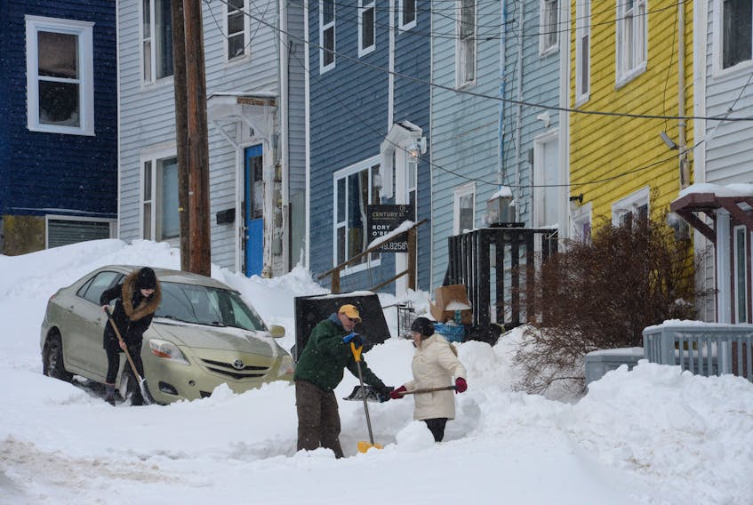
And since the new year arrived on Tuesday, the St. John’s metro area and other parts of the province have contended with a double-blast of storms that saw businesses and services shut down.
SaltWire Network meteorologist Cindy Day predicts this winter is going to be colder than average and there will be more snow than usual.
“We are off to a colder and more wintery start,” she said. “We had above average snowfall in November and above average snowfall in December. We’ve already had 25 centimetres this month and we are only Day 2 (Wednesday). We are tracking colder and snowier than we were the past couple of winters, particularly the early part.”
According to Environment Canada, wind and snow warnings were in effect for many areas of the province Wednesday — the island portion of the province and the south coast of Labrador were all under weather warnings from New Year’s Day evening continuing into Thursday morning.
The Avalon Peninsula and the east and south coasts of the island were in blizzard conditions much of the past two days. There was near zero visibility on roads and highways throughout the Avalon with snowfall amounts expected between 10 to 30 cms.
"So the jet stream right now is just off the Avalon and so the systems are tracking along that jet stream, the jet stream gives them a little bit of energy and the proximity of the jet stream brings the precipitation."
— Cindy Day, SaltWire Network Meteorologist
Day said with the current position of the jet stream, there should be a barrage of fast-moving weather systems over the next week or so. The first will track offshore Thursday afternoon with a light offering of snow — two to four centimetres for the Avalon.
“We’ll enjoy a welcome break between systems on Saturday, but western regions will see some snow start up as early as late afternoon,” she said. “Sunday is going to be messy. Snow is expected to change to rain across western mainland Nova Scotia but the cold side of the system could dump 10 to 15 cms over P.E.I, southeast New Brunswick and western Newfoundland by Monday morning.
“I’m watching a developing area of low pressure over the American Midwest that has its sights set on Atlantic Canada for the middle part of next week.”
Day noted that observations made about the position of the jet stream to Newfoundland and Labrador and the rest of Atlantic Canada are holding true as we move into the January to March period.
“Late fall, November into December, when people were asking what kind of winter are we going to have, it really looked to me — and it seems to be unfolding this way — that we are going to be close enough to the jet stream to have significant precipitation.
“The systems in the upper atmosphere travel along the jet stream, and the nearer the jet stream is to your location, the more precipitation you will get, whether it’s summer or winter. So the jet stream right now is just off the Avalon and so the systems are tracking along that jet stream, the jet stream gives them a little bit of energy and the proximity of the jet stream brings the precipitation.”
Related story:
Overnight blizzard wallops Eastern Newfoundland, with more wintery weather on the way